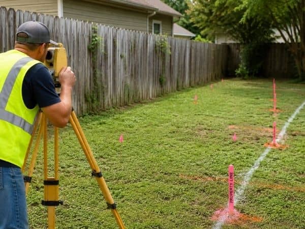
A construction survey is the quiet work behind every road that drains properly. It’s also behind every curb that sits exactly where it should. Most drivers never think about it. They just notice when a road floods after a storm, or when water pools in the same spot every spring. Those problems usually trace back to elevations that drifted off plan during construction, and accurate survey data is the only way to catch that drift early.
Roads and drainage systems are built on tolerances measured in inches, sometimes fractions of an inch. Get those numbers wrong, and water stops moving the way engineers designed it to move. Get them right, and a road performs the way it’s supposed to for decades.
Why Precise Elevation Control Matters for Road and Drainage Performance
Water doesn’t care about good intentions. It follows the lowest point available. On a road or drainage system, that lowest point needs to sit exactly where the design says it should. A curb that’s half an inch higher than planned can be enough to trap water instead of letting it flow toward a drain. A road grade that’s slightly off can create a low spot that turns into a puddle every time it rains.
These differences sound small on paper, but they compound fast. A half-inch error here and a quarter-inch error there can add up quickly. The result is a section of road that ponds water for hours after a storm. Nothing about it looks wrong to a casual glance. The pavement looks fine. The curb looks straight. The problem only becomes obvious once water starts sitting where it shouldn’t.
This is exactly why construction survey data matters so much during the build. Surveyors set and check elevations constantly. They compare what’s actually being built against the engineered plan. Catching a grading error while it’s still dirt is simple. Catching it after asphalt has been poured over it is not.
Construction Survey Data Guides the Placement of Culverts and Stormwater Structures
Culverts, inlets, and manholes only work if they sit exactly where the design puts them. That means correct location and correct elevation. Survey control points give contractors a fixed reference for placing these structures. Without that reference, crews end up relying on visual estimates that can drift over the course of a long workday.
A culvert set even a few inches off its designed elevation can change how water moves through it. Set too high, it won’t capture runoff the way it’s supposed to. Set too low, it can create a sump that collects sediment and debris faster than it was designed to handle. Storm drain inlets and manholes face the same risk. They need to align precisely with the pipe network connecting them underground.
Construction crews rely on survey stakes and grade references to keep these structures honest throughout installation. Without that constant check, small placement errors creep in one structure at a time. By the end of a project, those small errors can add up. The drainage system technically exists, but it doesn’t perform the way it was designed to.
Keeping Road Grades Consistent From One Phase of Construction to the Next
Road construction happens in stages. Rough grading comes first, then base material, then paving. Each phase needs to match the elevations set in the phase before it. A road built in stages without consistent survey checks can end up with grade inconsistencies. Nobody notices until the final surface goes down.
This consistency matters for more than just smooth driving. Pavement performance depends on water draining off the surface quickly and evenly. A road with subtle grade variations from one section to the next can develop low spots. Water sits on the pavement instead of running off, which speeds up wear. That creates conditions for potholes to form years before they should.
Construction surveys keep every phase tied back to the same reference points. A grading crew working in week two and a paving crew working in week eight both build toward the exact same design elevations. That continuity is what keeps a finished road performing the way it was engineered to, long after the construction equipment has left the site.
Detecting Grade Deviations Before They Affect Finished Infrastructure
Even with careful planning, grades can drift during construction. Equipment settles ground differently than expected. A grading crew works slightly off a stake. Weather shifts soil more than anticipated. None of this is unusual. That’s exactly why survey crews check elevations throughout the build, not just at the start and end.
A few specific checks tend to catch problems early, before they get buried under the next phase of work:
- Verifying subgrade elevations before base material goes down
- Confirming pipe inverts and structure tops before backfilling
- Checking finished grades before final paving begins
Catching a deviation at any of these stages means a simple fix. Regrading a few inches of dirt costs very little. Catching the same deviation after asphalt or concrete is already in place is a different story. That means cutting into finished work, which costs far more in both time and money. Survey crews exist precisely to catch these issues at the cheap stage instead of the expensive one.
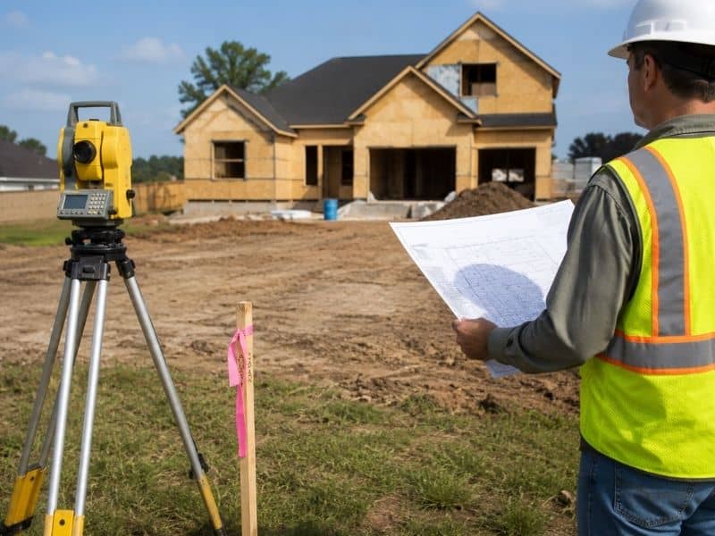
Why Builders and Developers Rely on Construction Surveys for Site Coordination
A construction site involves a lot of different crews working from the same set of plans. Often they’re working at the same time. Grading crews, utility contractors, paving teams, and engineers all need to build toward identical reference points. Otherwise their individual pieces of work won’t line up when it’s time to connect them.
Construction survey data gives every one of these crews a shared, verified starting point. A utility contractor laying pipe needs the same elevation references as the paving crew working the surface above it. An engineer reviewing progress needs confidence that what’s been built actually matches what was designed. Without consistent survey control tying all of this together, coordination breaks down fast. Mistakes that seem minor on their own start compounding across the project.
This is part of why experienced builders treat construction surveys as a core part of the schedule, not a formality. Good survey data keeps a complicated, multi-crew project moving in the same direction. It’s often the difference between a project that finishes on time with infrastructure that performs as designed, and one that ends up with costly rework after the fact.
Frequently Asked Questions
What is a construction survey?
A construction survey provides layout and elevation information that helps contractors build roads, utilities, and drainage systems according to design plans.
Why are construction surveys important for drainage systems?
Construction surveys ensure drainage structures are installed at the proper elevations so water flows as intended across the site.
Can construction surveys help prevent standing water problems?
Yes. Accurate survey data helps maintain proper grades and slopes, reducing the likelihood of ponding and drainage issues.
When are construction surveys performed during a project?
Construction surveys are used throughout the project, from initial layout and grading to final verification of completed improvements.
Who uses construction survey data on a job site?
Builders, developers, engineers, utility contractors, paving crews, and project managers all rely on construction survey information to keep work aligned with the design plans.