Can You Build Without a Recent Land Survey?
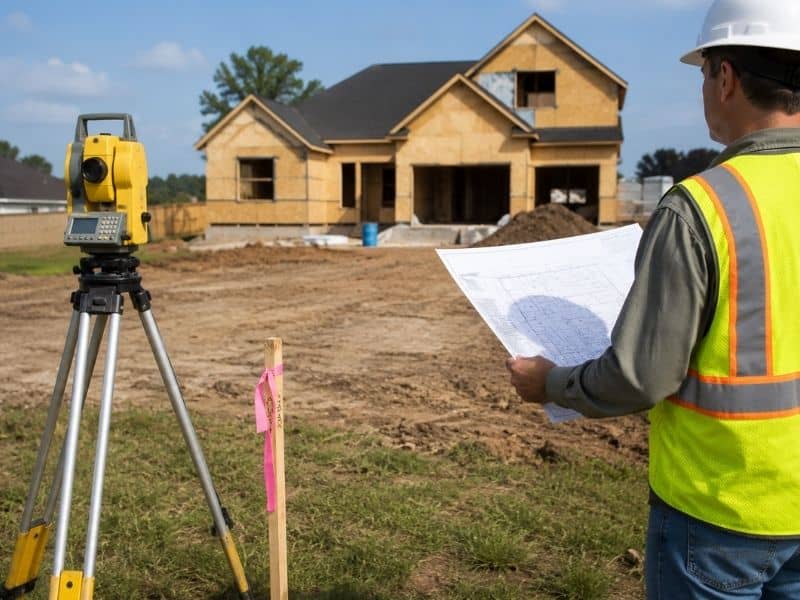
A recent land survey may not be the first thing people think about before starting a construction project. Most property owners focus on building plans, permits, contractors, and budgets. The lot may look clear and ready for work. Everything appears simple at first. Then questions start coming up. Does the structure fit within the property lines? Are there setback restrictions? Is there an easement crossing part of the land?
Many projects begin with assumptions. Accurate property information can help prevent those assumptions from becoming expensive problems later.
In some situations, construction planning may begin without updated survey information. However, building without recent property data creates risk. Land conditions, records, and site features can change over time.
A survey from years ago may not reflect current conditions on the property today. Nearby development, utility work, property improvements, and changing land records can all affect what exists on the site.
Even if the land has been owned for many years, important details can still be missed.
Why Older Survey Information May Not Tell the Full Story
Many property owners assume an older survey remains accurate forever. That is not always true.
Properties change over time. Improvements get added. Nearby construction can alter conditions. Property markers can disappear or become difficult to locate.
Some changes that can affect older survey information include:
- New driveways
- Added fences
- Utility installations
- Easement changes
- Land divisions
- Missing property markers
- Site improvements
None of these automatically create problems. They simply create reasons to verify current property conditions before construction starts.
A survey completed years ago may not answer today’s questions.
Construction Projects That Often Need Updated Property Information
Not every project requires the same level of review. Smaller projects may appear straightforward, but exact measurements often become important once construction planning begins.
Updated survey information often helps with projects such as:
- Building a new home
- Constructing a detached garage
- Adding a workshop
- Installing a driveway
- Building a fence
- Planning commercial site improvements
- Adding room additions
A homeowner planning a workshop may believe there is plenty of available space behind the house. Everything looks fine from a visual inspection.
Then survey information reveals a setback requirement or property line issue.
Now placement changes.
Design adjustments follow.
Simple projects sometimes become more complicated than expected.
What Property Setbacks and Easements Can Mean for a Project
Many people hear the words setback and easement but never fully understand how they affect construction.
A setback is a required distance between a structure and a property boundary. Local building regulations often control these limits.
An easement gives certain rights for access or utility use across part of a property.
For example, utility lines may cross a section of land where building restrictions apply.
Without updated property information, someone may plan construction in an area that cannot legally support it.
Discovering this after construction begins can create delays and unexpected costs.
Sylacauga Properties Can Present Unique Site Questions
Properties around Sylacauga and nearby parts of Talladega County vary quite a bit. Some lots sit closer to developed neighborhoods. Others involve larger rural tracts that have remained unchanged for many years.
Local property conditions can create challenges that are not obvious from the road.
Property owners may encounter:
- Older family-owned land
- Rural acreage
- Rolling terrain
- Historic parcel divisions
- Missing property markers
- Mixed land uses nearby
A property can appear open and simple while still containing details that affect future construction plans.
Local conditions often shape building decisions more than people realize.
Problems That Can Happen Without Updated Survey Information
Imagine a homeowner planning a detached garage.
The location seems perfect. Measurements look fine using visible fences and landmarks. Construction planning moves forward.
Later, updated survey information reveals that the planned structure sits too close to a property line.
Now the owner faces changes.
New drawings may be required. Permit reviews may slow down. Contractors may need revised plans.
Potential issues include:
- Structures placed too close to property lines
- Easement conflicts
- Setback violations
- Permit delays
- Design changes
- Added project costs
Problems discovered after construction begins usually create more work than problems found during early planning.
Accurate Property Information Helps Projects Move Forward
Building projects involve many moving parts. Property information often becomes one of the most important pieces.
A recent land survey does not exist to create extra work. It helps property owners understand what is actually happening on the site before decisions are made.
For people building, accurate information early can help reduce delays and avoid unnecessary surprises.
Land may look ready from the outside.
The survey often tells the full story.
Frequently Asked Questions
Can an old land survey still be used?
Sometimes. Older surveys may still provide useful information, but site conditions and property details can change over time.
Can fences identify property lines?
Not always. A fence location does not automatically confirm a legal property boundary.
Why do setbacks matter before building?
Setbacks control where structures may be placed on a property and help maintain spacing requirements.
Can utility easements affect building plans?
Yes. Easements can limit where structures may be placed.
Should property owners verify survey information before construction?
Many do. Updated property information can help identify issues before building begins.