How Much Does a Land Survey Cost?
A property can look ready for development at first glance. Open ground. Easy road access. Plenty of space. Then the survey starts and new details show up.
A property line may sit farther than expected. A utility easement may cut across part of the lot. A slope that looked minor from the road may create grading challenges.
Developers often focus on land price, construction costs and permits during early planning. Survey work deserves attention too. Survey costs vary for a reason. Knowing what affects them can help prevent budget surprises and keep projects moving.
Why Survey Costs Show Up Earlier Than Many Developers Expect
Many developers think surveys happen after plans are complete. In reality, surveys often come first.
Design teams rely on accurate property information. Engineers need dimensions. Architects need site details. Local approvals often require clear land data before a project moves forward.
Starting without accurate survey information creates risk. A mistake at the beginning can follow the project for months.
Early Budget Mistakes Can Carry Through the Whole Project
One missing detail can affect several parts of a project.
Examples include:
- Revised site layouts
- Permit delays
- Added engineering work
- Extra field visits
- Design changes after plans are complete
Changing plans later usually costs more than getting accurate information early.
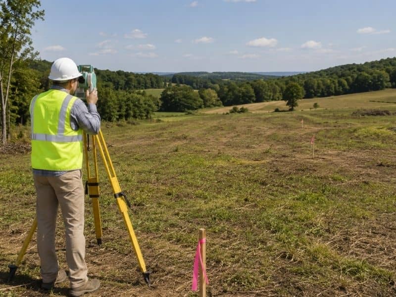
What Happens During a Land Survey?
Many people see survey crews on a site and assume the work begins and ends there. The field visit is only part of the process.
Survey teams often start with property research. They review deeds, maps and public records. Crews then visit the site and collect measurements using survey equipment.
After field work ends, information still needs review. Data gets processed and prepared for final survey documents.
Developers pay for more than flags in the ground.
Time on Site Is Only Part of the Job
Field crews may spend a few hours or several days on a property. The amount of office work afterward can vary too.
Large sites often require more calculations. Older properties may need extra record research. Some projects involve comparing multiple documents to confirm details.
That work affects pricing.
Why Two Similar Lots Can Have Very Different Survey Costs
Two properties may have the same acreage and still produce different survey costs.
The reason is simple. Land conditions matter.
A Clean Open Site Moves Faster
A property with open visibility and good access often requires less field time.
Survey crews can move through the site faster. Existing markers may already be visible. Nearby records may also be easier to verify.
That can reduce labor time.
Older Tracts Can Create Extra Work
Some properties around Sylacauga have been owned by families for many years.
Older parcels sometimes come with:
- Unclear property corners
- Older legal descriptions
- Missing markers
- Previous land divisions
- Records that need more review
None of these issues mean something is wrong. They simply require more time.
Time affects cost.
Sylacauga Land Conditions That Can Affect Survey Work
Sylacauga and nearby parts of Talladega County have a mix of property types. Some sites sit closer to developed areas. Others involve larger tracts outside town.
Different site conditions can change how survey crews approach a project.
A large rural property may require more travel across the site. Heavy vegetation can slow work. Older parcels can require additional research.
Developers planning projects in growing areas sometimes run into another issue. Surrounding land may have changed over time.
New roads, utility work or nearby improvements can create questions that need review.
Small details can shape survey pricing.
Questions Developers Should Ask Before Buying Property
A land purchase often moves fast. Asking a few questions early can prevent expensive surprises.
Consider asking:
- Has the property been surveyed recently?
- Are property corners identified?
- Is legal access recorded?
- Have parcel lines changed before?
- Are there visible issues on site?
Simple questions can uncover problems before development plans begin.
Spending Less Upfront Can Lead to Bigger Costs Later
Picture a developer purchasing a parcel based on old records.
Everything looks fine during early planning. Design work starts. Then new survey work finds a property line issue near a planned access area.
Plans change.
Engineering changes follow.
Permit review slows down.
Early savings disappear quickly.
Planning Survey Costs Into a Development Budget
Survey costs should be part of early project planning, not a last-minute item.
Gather property records before reaching out to a surveyor. Share project goals early. Explain whether the site will involve future development phases.
Clear communication often helps avoid unnecessary work.
Developers spend a lot of time estimating site work, utilities and construction costs. Accurate land information belongs on that list too.
Projects move faster when teams start with reliable property data.
Frequently Asked Questions
Can land with road access still have survey issues?
Yes. Road frontage does not always mean property boundaries or access rights are clear.
Why do older properties sometimes cost more to survey?
Older parcels can require more record research and field verification.
Can site history affect survey work?
Yes. Previous land divisions and ownership records can create additional review work.
Should developers order survey work before buying land?
Many do. Survey information can reveal site concerns before a purchase closes.
Can nearby properties affect a survey?
Yes. Fences, access routes and neighboring improvements sometimes require review.