↓
 

Sylacauga Land Surveying

Your Choice for Surveying in Sylacauga, AL.....

Sylacauga Land Surveying
  • Home
  • ALTA Survey Sylacauga, AL
  • Civil Engineering
  • Drone LiDAR Mapping
  • Elevation Certificate
  • Land Surveying
  • Property Survey – Boundary Survey
  • Topographic Survey | Topo Survey
  • Contact Us
  • Blog
Home→land surveying→Why Engineers Request Topographic Surveys Early →Topographic survey aerial land elevation mapping

Image navigation

Next →

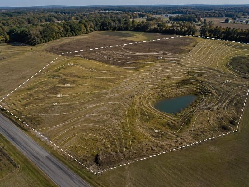
Topographic survey aerial land elevation mapping

Published May 21, 2026 at 800 × 600 in Why Engineers Request Topographic Surveys Early

Image navigation

Next →
Get Quote Button
© Copyright Tucker Engineering, LLC
SylacaugaLandSurveying.com
Sylacauga, Alabama
Phone:(256) 369-4020

Web Development and SEO by:
N2Biz.co


Privacy Policy | Terms of Use

&nbsp Privacy Policy
↑